| |
| |
 |
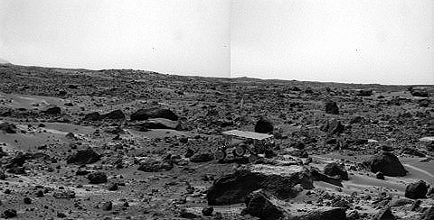
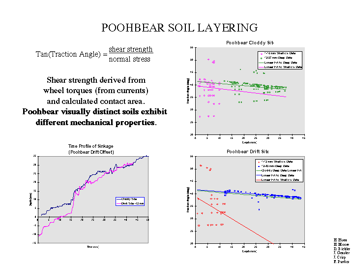
| This chart illustrates evidence of layering found with the Sojourner rover soil mechanics experiment. In this investigation, the rover wheels are spun while simultaneous measurements of motor currents, vehicle kinematic configuration, and temperature are recorded. From these data, wheel torque and, in turn, shear force at the soil/wheel interface are computed. This tractive coefficient (analogous to friction coefficient) is used to characterize the soils. |
 |
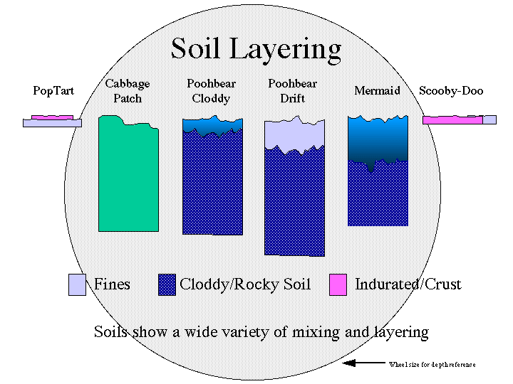
| The chart above shows graphical representations of some soil structures determined by the Sojourner rover soil mechanics experiment. |
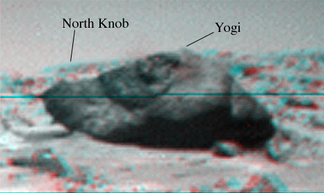 |
| This stereo anaglyph of the rock "Yogi" is a portion of an image taken by the Sojourner rover on Sol 70. Much of Yogi visible in this image cannot be seen from the perspective of the Pathfinder lander. To view this image in stereo, use glasses with a red left eye and blue right eye. |
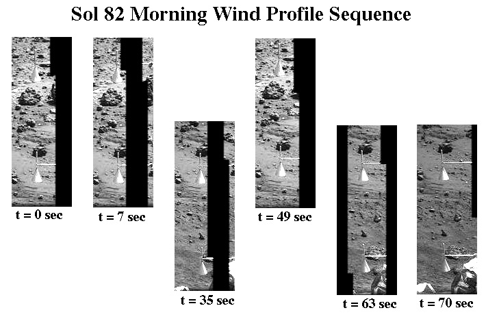 |
| This set of images shows the Pathfinder wind socks on the morning of Sol 82 (September 25). The top frames show the upper and middle sock and the bottom frames show the middle and lower socks. Movement of the lower and middle sock is apparent. Deflections of the three wind socks are used to estimate characteristics of the wind speed boundary layer profile. |
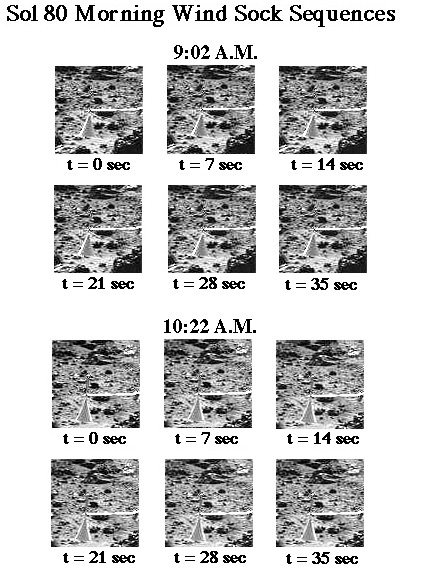 |
| This set of images shows the Pathfinder upper wind sock during two time periods on the morning of Sol 80 (September 23). The interval between frames within each sequence is one second. There is no obvious movement of the sock, indicating little or no wind at this elevation (about 1 meter above the surface). At other times during the mission, deflections of this and two lower wind socks have been used to estimate characteristics of the wind speed boundary layer profile. |
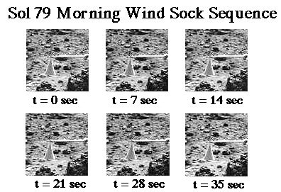 |
| This sequence of images shows the Pathfinder upper wind sock on the morning of Sol 79 (September 22). The interval between frames is seven seconds. As in the images posted on the web for Sol 73, there is no obvious movement of the sock, indicating little or no wind at this elevation (about 1 meter above the surface). At other times during the mission, deflections of this and two lower wind socks have been used to estimate characteristics of the wind speed boundary layer profile. |
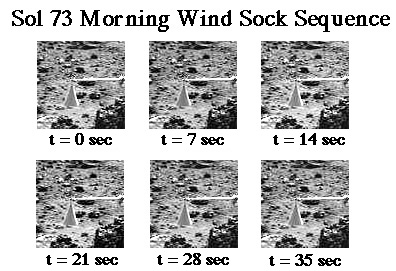 |
| This sequence of images shows the Pathfinder upper wind sock on the morning of Sol 73 (September 16). The interval between frames is seven seconds. There is no obvious movement of the sock, indicating little or no wind at this elevation (about 1 meter above the surface). At other times during the mission, deflections of this and two lower wind socks have been used to estimate characteristics of the wind speed boundary layer profile. |
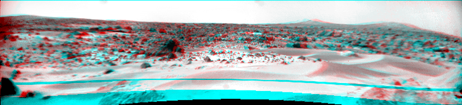 |
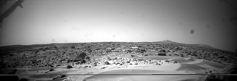
| This stereo Sojourner rover image taken on Sol 76 shows foreground dunes and, on the horizon, the rim of "Big Crater" (left, 2.2 km away) and the "Twin Peaks" (right, about 1 km away). To see this image in 3-D, use glasses with a red left eye and blue right eye. |
 |
| This stereo Sojourner rover image taken on Sol 75 shows foreground rocks and, on the horizon, "North Peak" (0.86 km away). To see this image in 3-D, use glasses with a red left eye and blue right eye. |
 |
| The rock "Shark" is seen close-up in this stereo Sojourner rover image. To view this image in 3-D, use glasses with a red left eye and blue right eye. |
 |
 |
| This stereo image pair taken on the morning of Sol 80 (September 23) shows the Sojourner rover with its Alpha Proton X-ray Spectrometer (APXS) deployed against the rock "Chimp." On the left horizon is the rim of "Big Crater," 2.2 km away. |
|
| This set of images shows the Pathfinder upper wind sock during two time periods on the morning of Sol 80 (September 23). The interval between frames within each sequence is one second. There is no obvious movement of the sock, indicating little or no wind at this elevation (about 1 meter above the surface). At other times during the mission, deflections of this and two lower wind socks have been used to estimate characteristics of the wind speed boundary layer profile. |
|
|
| This stereo image pair taken on the morning of Sol 80 (September 23) shows the Sojourner rover with its Alpha Proton X-ray Spectrometer (APXS) deployed against the rock "Chimp." On the left horizon is the rim of "Big Crater," 2.2 km away. |
|
| This set of images shows the Pathfinder upper wind sock during two time periods on the morning of Sol 80 (September 23). The interval between frames within each sequence is one second. There is no obvious movement of the sock, indicating little or no wind at this elevation (about 1 meter above the surface). At other times during the mission, deflections of this and two lower wind socks have been used to estimate characteristics of the wind speed boundary layer profile. |
|
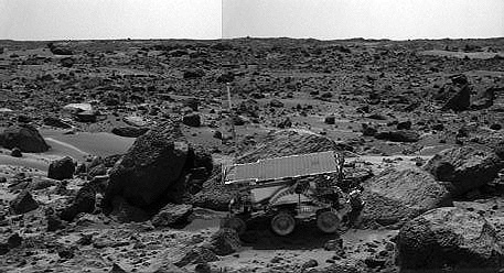
| This color image taken by the Sojourner rover's rear camera on Sol 78 (September 21) shows the Alpha Proton X-ray Spectrometer (AXPS) deployed above the rock "Chimp." Fine-scale texture on Chimp is visible. Sojourner's rear camera is used to pinpoint the position of the APXS on target rocks and soils. |
| ||
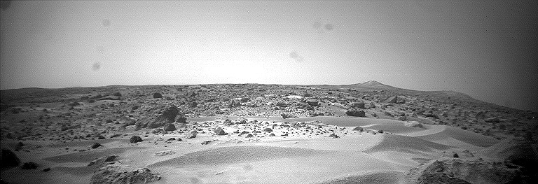
| This stereo image pair taken by the Sojourner rover's front cameras was taken on Sol 76. The "Twin Peaks" (~ 1 km away) are seen on the right horizon, as is "Big Crater" (2.2 km away) at left. This new viewing perspective shows dunes and rocks not visible from the Pathfinder lander. |
| ||
|
|
 |
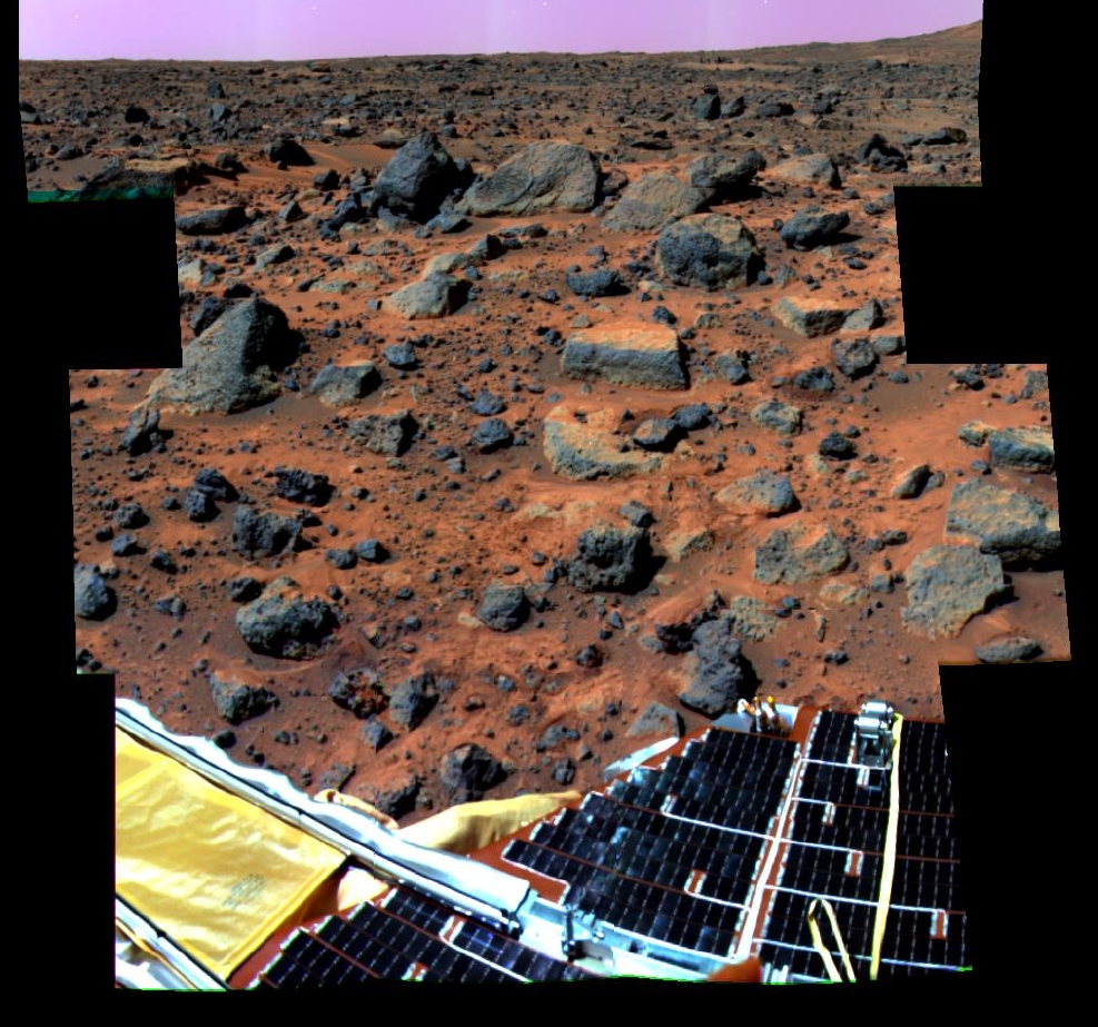
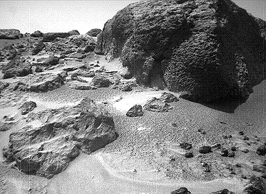
Super-pan octant S0184 This enhanced color image mosaic of the Rock Garden area west of the lander was made using images acquired in the mid-morning of Sol 32 by the IMP camera as part of the Super-Pan data set. At each camera frame position, a Super-Pan image contains fifteen frames---six frames for three-color stereo and nine more individual narrow color bands. This mammoth color and stereo data set will be used to derive high quality topographic maps of the surface and detailed shapes of rocks and other surface features, and to map subtle chemical, mineralogical, and textural variations on rocks and soils. Red, green, and blue filter images from the right eye were combined to simulate slightly amplified natural color. The "bookshelf" rocks visible in the background include Shark, Half-Dome, Moe, and Stimpy. The rover Sojourner completed imaging and APXS measurements of these rocks on Sol 71. Small rocks below and to the right of Flat Top appear to have been moved and/or pushed into the soil, probably by the spacecraft during landing. A portion of South Peak is visible in the upper right corner of the mosaic. One of the solar-panel-covered lander petals and the forward rover ramp are visible in the foreground. The Processing of this mosaic was done by the United States Geological Survey, Flagstaff, Arizona. |
This enhanced color image mosaic of the area south of the lander was made using images acquired in the mid-morning of Sol 13 by the IMP camera as part of the Super-Pan data set. At each camera frame position, a Super-Pan image contains fifteen frames---six frames for three-color stereo and nine more individual narrow color bands. This mammoth color and stereo data set will be used to derive high quality topographic maps of the surface and detailed shapes of rocks and other surface features, and to map subtle chemical, mineralogical, and textural variations on rocks and soils. Red, green, and blue filter images from the right eye were combined to simulate slightly amplified natural color. The rocks Squid, Ender, Hassock, and a portion of Wedge are visible in the center-right portion of the mosaic. Mermaid Dune and Bosco rock are visible in the middle-left. The foreground contains portions of the airbags and the top of the low-gain antenna on the lander. The rim of the impact crater "Big Crater" is visible in the upper-left on the horizon. The processing of this mosaic was done by the United States Geological Survey, Flagstaff, Arizona. |
|
|
This preliminary enhanced color image mosaic of the area northeast of the lander was made using images acquired in the afternoon of Sol 20 (top portion of the mosaic) and Sol 38 (bottom portion of the mosaic) by the IMP camera as part of the Super-Pan data set. The differences in brightness between the upper and lower portions of the mosaic result from slightly different sun angle positions between Sols 20 and 38, and can be compensated by subsequent analysis of the reflectance of surface rocks and soils under different lighting conditions. At each camera frame position, a Super-Pan image contains fifteen frames---six frames for three-color stereo and nine more individual narrow color bands. This mammoth color and stereo data set will be used to derive high quality topographic maps of the surface and detailed shapes of rocks and other surface features, and to map subtle chemical, mineralogical, and textural variations on rocks and soils. Red, green, and blue filter images from the right eye were combined to simulate slightly amplified natural color. The bright, flat areas Scooby Doo and Baker's Bench are visible left of center and above center in the mosaic, respectively. Airbags and a portion of one of the lander petals are visible in the foreground. The processing of this mosaic was done by the United States Geological Survey, Flagstaff, Arizona. |
This sequence of images shows the Pathfinder upper wind sock on the morning of Sol 73 (September 16). The interval between frames is one second. There is no obvious movement of the sock, indicating little or no wind at this elevation (about 1 meter above the surface). At other times during the mission, deflections of this and two lower wind socks have been used to estimate characteristics of the wind speed boundary layer profile. |
| ||
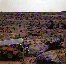
| This stereo image pair taken on the afternoon of Sol 74 (September 17) shows the Sojourner rover behind the rock "Chimp." Sojourner is now a record 12.3 m from the lander. |
| ||
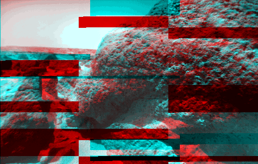
| These two views of the rock "Chimp" were acquired by the Sojourner rover's right front camera on Sol 74 (September 17). A large crack, oriented from lower left to upper right, is visible in the rock. A dark crust appears to cover Chimp in some areas whereas other parts of the rock have a lighter shading. A boundary between the two regions is clearly seen in the upper left part of Chimp. |
| ||
| This stereo image pair shows the Sojourner rover behind the large rock "Chimp" near noontime on Sol 75 (September 18). The rover's middle right wheel is raised above the surface. Sojourner is over 12 m from the lander, a mission record. |
 |
 |
| This stereo pair image mosaic shows the Sojourner rover near the large rock "Chimp" on the afternoon of Sol 72 (September 15). Prior to the acquisition of these images, Sojourner successfully traversed the terrain between Chimp and the "Rock Garden," an assemblage of large rocks to the right of this mosaic. |
 |
 |
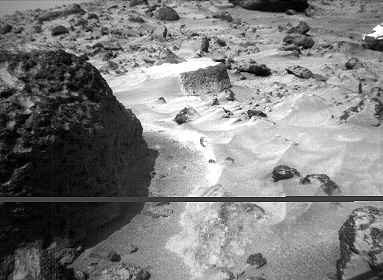
| This stereo image pair of the rock "Chimp" was taken by the Sojourner rover's front cameras on Sol 72 (September 15). Fine-scale texture on Chimp and other rocks is clearly visible. Wind tails, oriented from lower right to upper left, are seen next to small pebbles in the foreground. These were most likely produced by wind action. |
 |
 |
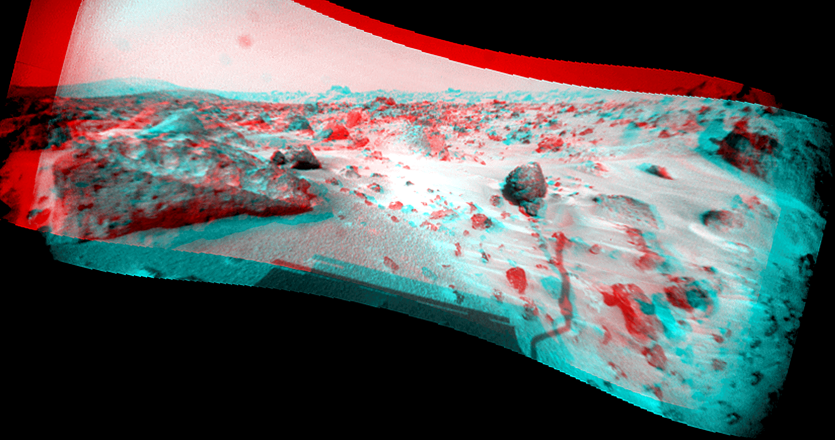
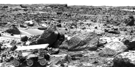
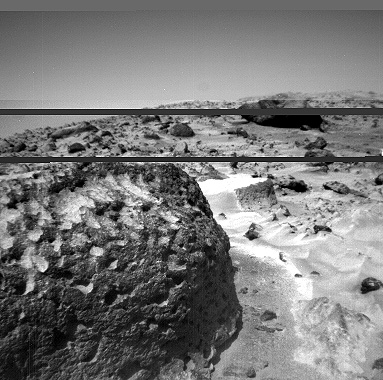
| This stereo image pair, taken on Sol 72 (September 15) from the Sojourner rover's front cameras, shows areas of the Pathfinder landing site never before seen. The large rock on the right is "Chimp." |
 |
 |
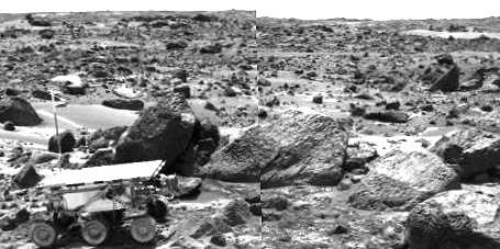
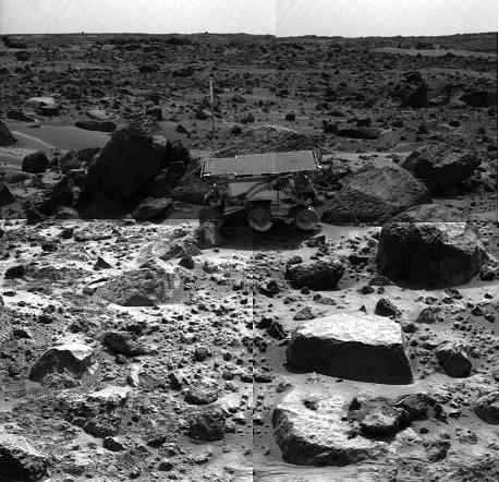
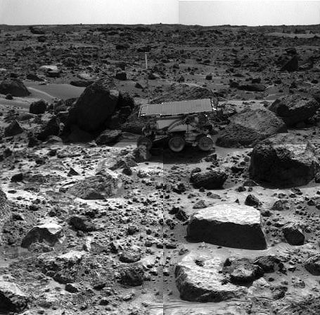
| This stereo image pair taken on the afternoon of Sol 71 (September 14) shows Sojourner leaving the "Rock Garden," an assemblage of large rocks behind and to the right of the rover. Sojourner's last target was the rock "Stimpy," seen at the far right. |
 |
 |
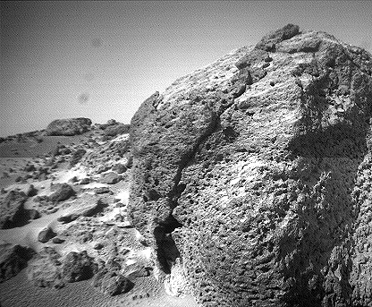
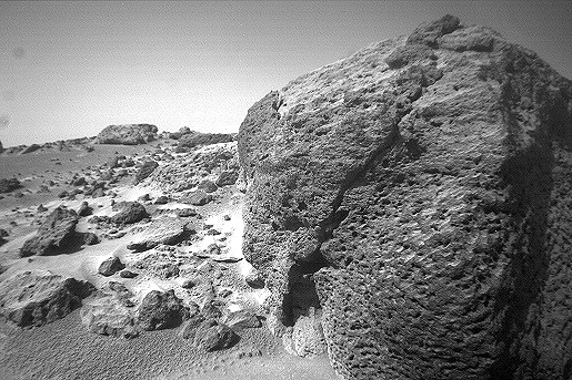
| This stereo image pair of the rock "Half Dome" was taken by the Sojourner rover's front cameras on Sol 71 (September 14). Pits, linear textures, and pronounced topography on the rock are clearly visible. |
 |
 |
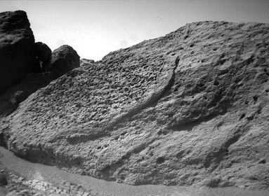
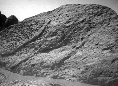
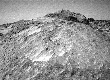
| This stereo image close-up of the rock "Moe" was taken from the Sojourner rover's front cameras on 70 (September 13). Flute-like textures on the rock, possibly caused by wind abrasion, are clearly visible. |
 |
 |
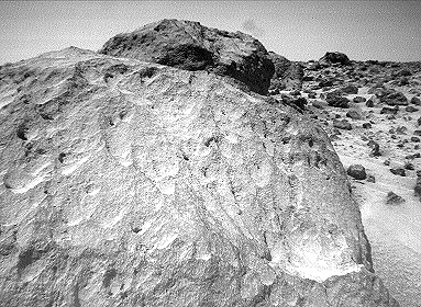
| The rock "Stimpy" is seen in this stereo close-up image pair taken by the Sojourner rover's front cameras on Sol 70 (September 13). Detailed texture on the rock, such as pits and flutes, are clearly visible. |
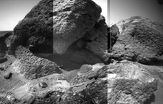 |
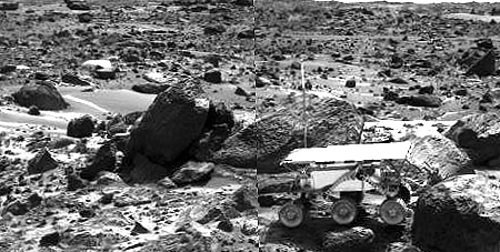
| This image mosaic of part of the "Rock Garden" was taken by the Sojourner rover's left front camera on Sol 71 (September 14). The rock "Shark" is at left center and "Half Dome" is at right. Fine-scale textures on the rocks are clearly seen. Broken crust-like material is visible at bottom center. |
 |
 |
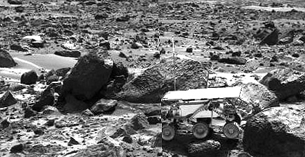
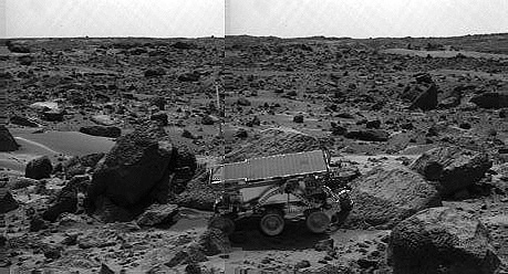
| This stereo image pair shows the Sojourner rover in the middle of the afternoon on Sol 66 (September 9). The rover has backed away from the rock "Moe" (to the right of the rover) after measuring its composition with the Alpha Proton X-Ray spectrometer. The next target for Sojourner, the rock "Stimpy," is in front of Moe. |
 |
 |
| This stereo image pair shows the Sojourner rover's Alpha Proton X-ray Spectrometer (APXS) deployed against the rock "Stimpy" on the afternoon of Sol 68 (September 11). The two rocks behind the rover were previously analyzed by the APXS. |
 |
| This color image shows the Sojourner rover's Alpha Proton X-ray Spectrometer (APXS) deployed against the rock "Moe" on the morning of Sol 65. The rock behind the rover is "Half Dome", which was previously measured by the APXS. |
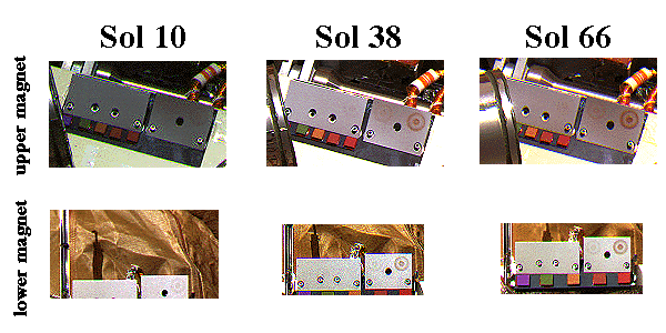 |
| This composite image shows particles adhering to magnetic target arrays on the Pathfinder lander. Each array consists of five magnets that increase in magnetic filed strength as seen from left to right. The red material forming a bull's-eye pattern on the arrays is magnetic Martian dust deposited from the atmosphere. An increase in magnetic dust deposition from Sol 10 to Sol 66 is clearly evident. By analyzing the patterns of dust on the various magnets, scientists are able to measure the dust's magnetic strength and infer its composition. |
 |
 |
| The Sojourner rover's Alpha Proton X-ray Spectrometer (APXS) is shown deployed against the rock "Moe" on the afternoon of Sol 64 (September 7). The rocks to the left of Moe are "Shark" (left of Sojourner) and "Half Dome" (behind Sojourner). They were previously measured by the APXS. |
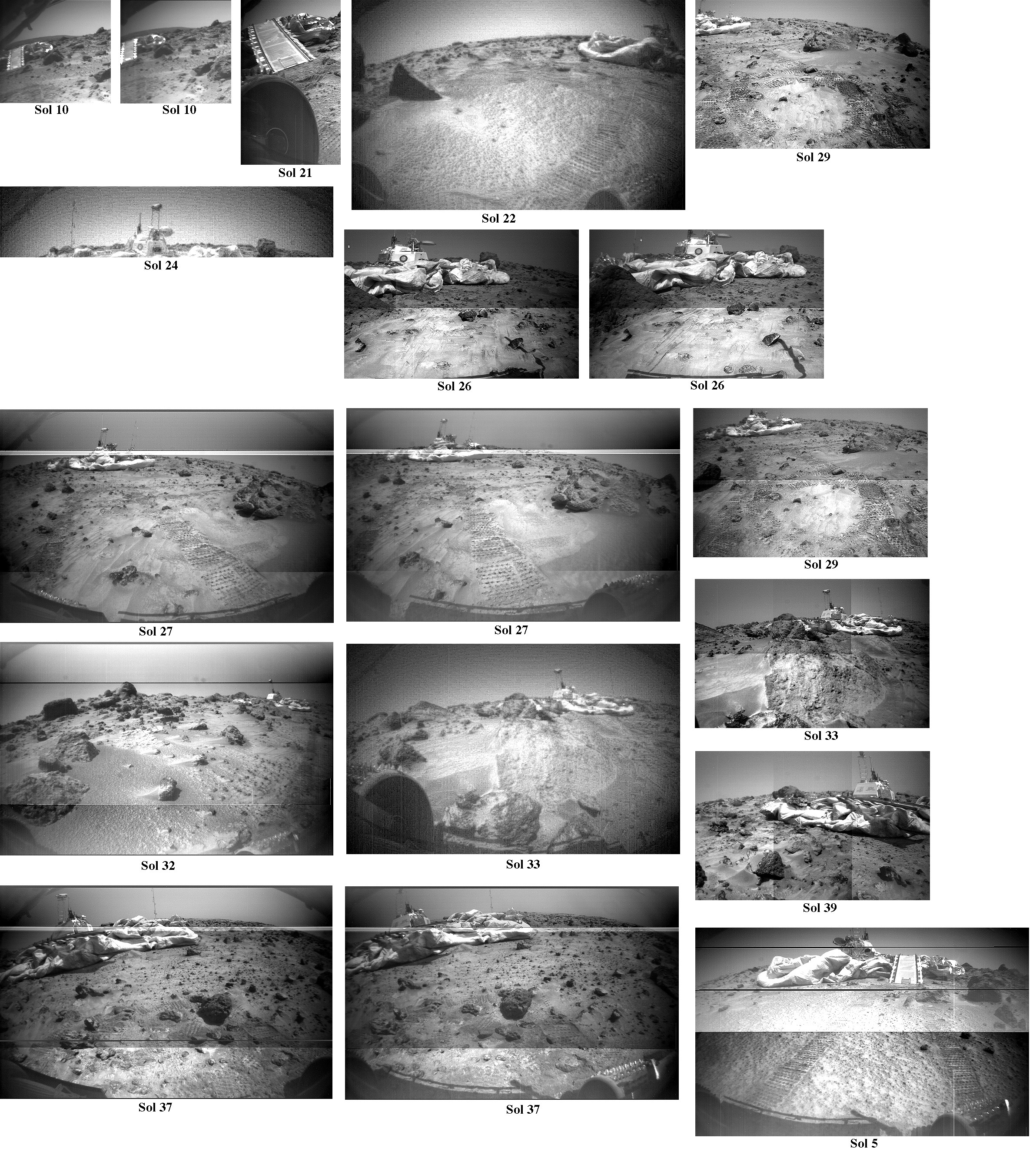 |
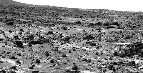
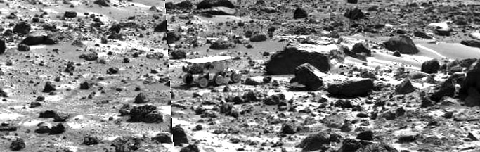
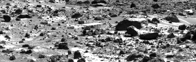
| This image montage shows every clear view of the Mars Pathfinder lander as seen from the Sojourner rover. The sol the image was taken is listed below each frame. |
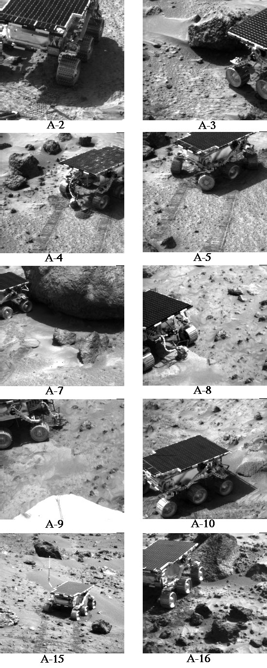 |
| This image montage shows every rover Alpha Proton X-Ray Spectrometer (APXS) deployment prior to Sojourner's entry into the "Rock Garden." The labels beneath each image are APXS measurement catalog numbers. Those not listed, such as A-1, were background measurements of the ambient Martian environment. |
 |
 |