 |
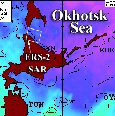
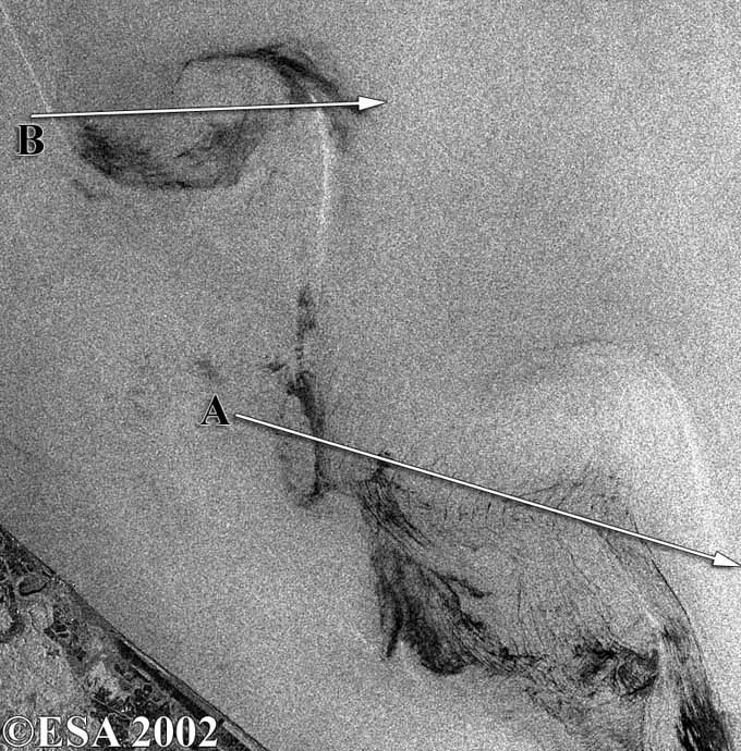
Datatake ERS-2 May 13, 2002 Okhotsk Sea Comment Cyclonic eddies on the front of the Soya Warm Current, La Perouse Strait. In the SAR image, the narrow bright band ~1 km wide is caused by current shift and starts near Kamen Opasnosti (Rock of Danger) where cold waters are located (see AVHRR image). The band is close to the boundary dividing warm (Soya) and cold (offshore) waters. (The position of the current shift zone may be different from the thermal boundary). The first eddy-like structure is located to the southeast of Rock of Danger. The eddy is better distinguished on the AVHRR image. The second eddy consisting of a cold core of the size of ~8 km and two spiral tails is clearly revealed on both images. The distance between tails is ~15 km and can be considered as the eddy's size. The third eddy also has the cold central area with SST equal to 5°C. The coldest waters (4°C) form a band to the southeast off the eddy's centre. The cold waters in the third eddy's area are characterized by decreased backscatter. The current shift zone (narrow bright band) is visible to the north of the eddy where SST is 6.5°. The eddies are located at a distance of ~25 km from the coastline and the distance between their centers is ~37 km which closely agrees with the results of numerical model experiments. Supplementary data Oceanographic Features Analysis of the Naval Oceanographic Office; Image intensity profiles A and B Image |