INTERBALL TAIL PROBE (IB_TAIL)
Last day of flight in the topocentrical coordinate system of the "landing poin"


Ballistic life-time

Orbit trace geographical coordinates on the last day of flight

Predicted "landing point" coordinates

Orbit in the topocentrical c/s of the "landing point"

The local topocentrical C/S connected with arbitrary point Lp on the Earth surface:

  • Origin on the point Lp
  • XYlp is the plane of the local horizont
  • Zlp- axis is directed to the local zenith.
  • Xlp-axis is pointed to the South
  • Ylp-axis complet the right three and is pointed to the East. To the top

    SC topocentrical distance: SC distance from the Lp point.

    Elevation: The SC angular distance from the local horizontal plane. The range of the elevation is (-90 : 90) deg. In case negative value of the elevation SC is under plane of the local horizont. To the top

    Azimuth: The longitude of the SC in the topocntrical C/S is measured in the local horizontal plane from the South to the East). The range of the azimuth is (0 : 360) deg.

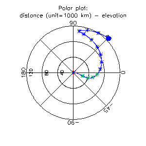
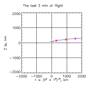
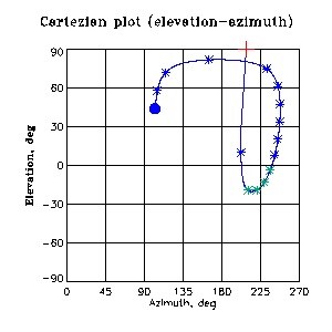
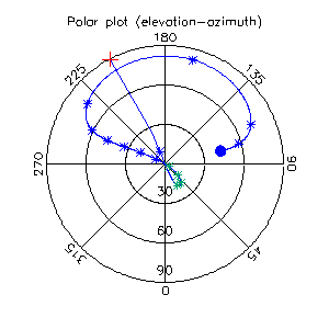
  • The last day of flight is shown in the predicted "landing point" (Lp) local topocentrical coordinate system. The blue circle cporrespons to 0.0 UT. The blue star marks the SC position with 1-hour step, the red star marks the last 3 min of flight with 1-min step, the red cross marks the predicted moment of the "landing". The green star marks the part of orbit corresponding to the negative value of the elevation.

    SC distance from the Lp as a fuction of the elevation


    SC elevation as a function of the azimuth


    Modified 16 October, 2000


    IKI RAN | SSC IKI RAN | INTERBALL mission